 vesseltracker.com
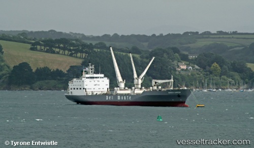
Vessel MURCIA CARRIER IMO: 9063665, MMSI: 538009575 Refrigerated Cargo Ship
UTC, -7.12185, -10.18519, course: 41, speed: 13.7
UTC, -6.33105, -9.51958, course: 40, speed: 13.8
2026-02-25 22:57:36 UTC, -6.15951, -9.37421, course: 39, speed: 13.8
Live AIS position:
UTC. 315 nm E of Ascension),
updated 2026-02-25 22:57:36 UTC.
Find the position of the vessel MURCIA CARRIER on the map. The latter are known coordinates and path.
marine traffic ship tracker show on live map
The current position of vessel MURCIA CARRIER is -6.15951 lat / -9.37421 lng. Updated: 2026-02-25 22:57:36 UTCCurrently sailing under the flag of Marshall Islands
MURCIA CARRIER built in 1996 year
Deadweight:
9357 tDetails:
Last coordinates of the vessel:
UTC, -7.47524, -10.48882, course: 41, speed: 13.9UTC, -7.12185, -10.18519, course: 41, speed: 13.7
UTC, -6.33105, -9.51958, course: 40, speed: 13.8
2026-02-25 22:57:36 UTC, -6.15951, -9.37421, course: 39, speed: 13.8